Larkspur Hills to Grass Lake
Date: March 14, 2025
Conditions: Low overcast, 6°C, light breeze.
7:45 AM - Charters River Fish Hatchery
Arrived at the Charters River Fish Hatchery and parked in the designated hiker's area. The weather was low overcast with an all-day drizzle forecasted. We started at the trailhead on a road servicing the Charters River dam. Passing under the Charters River Trestle, we veered off trail onto an old track. This led us to an overgrown trail that resembled a game trail rather than a well-maintained route.

Larkspur Hills
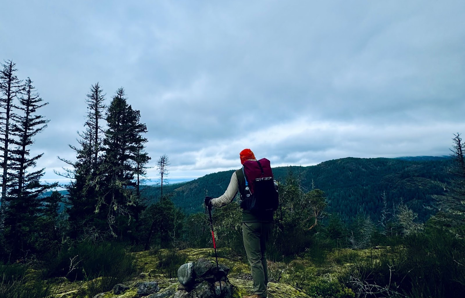
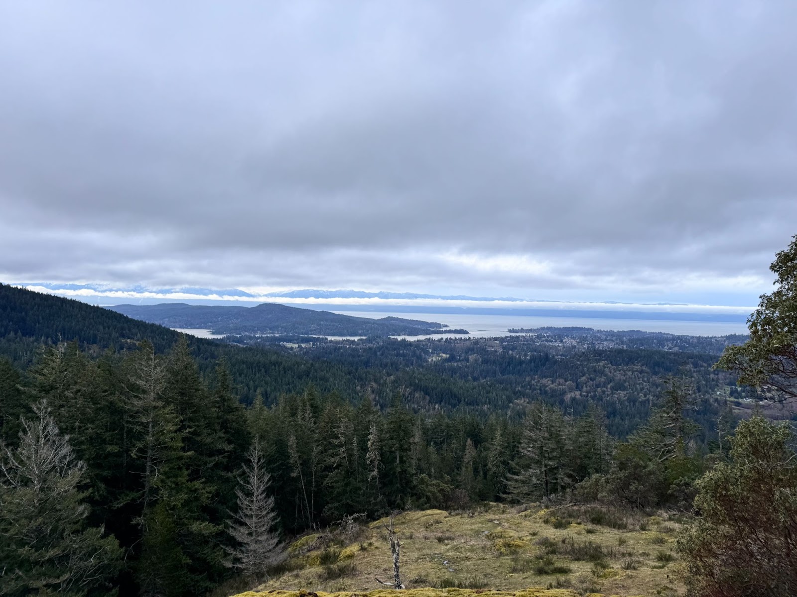
We crossed the Sooke Flowline and took the trail up the South face of Larkspur Hills, gaining just over 300 meters of elevation. Looking back, we were rewarded with views of the Sooke Basin and glimpses of the Olympic Mountains across the Salish Sea, with sunlight breaking through the clouds.
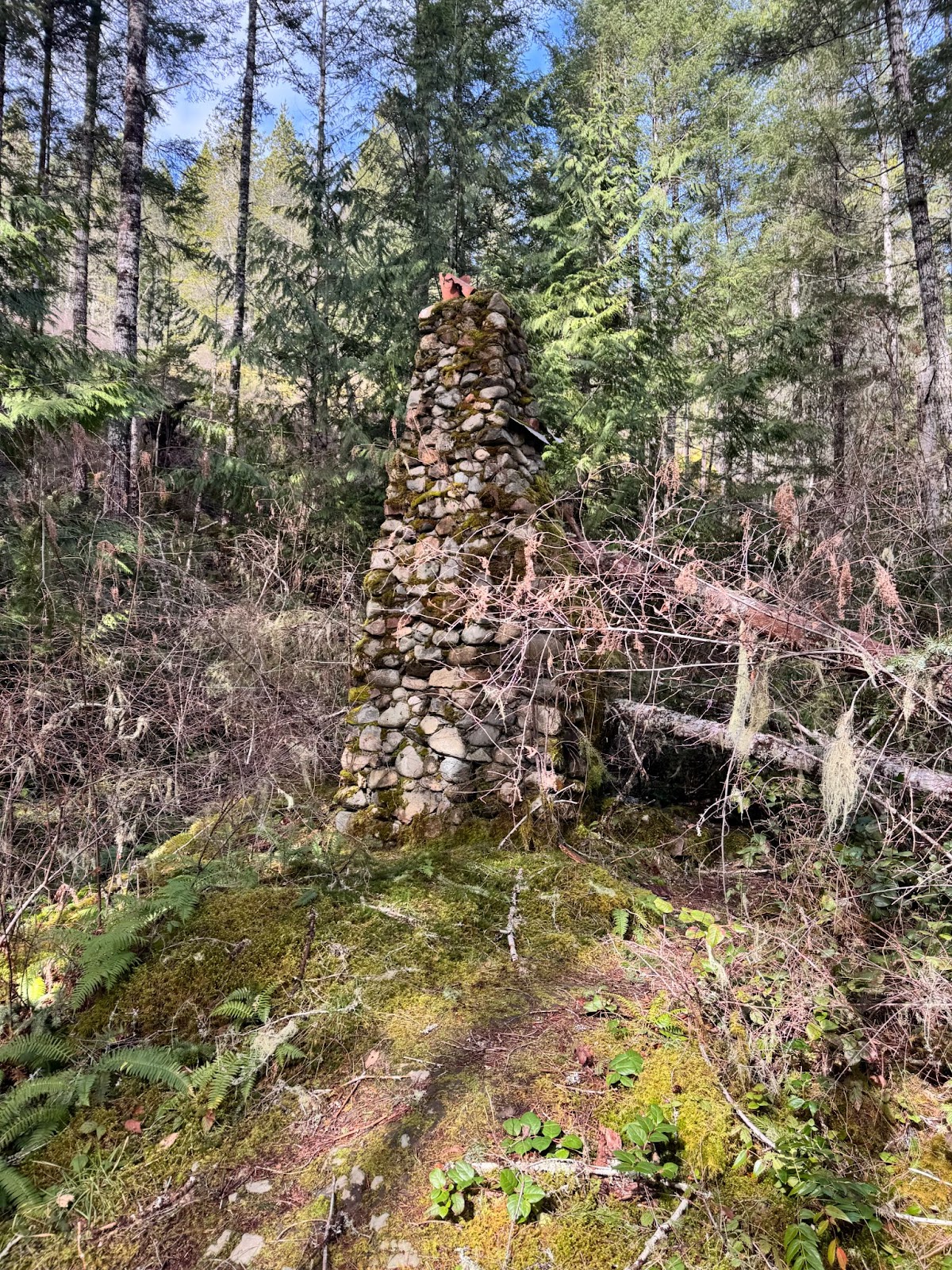
- Larkspur South Summit: Marked by a rustic cairn, offering nice views towards Black Bear Mountain and further into the CRD watershed.
- Larkspur North Summit: A short walk from Larkspur South, this summit was unremarkable—a mossy knoll of bedrock surrounded by second- and third-growth forest. The ridge had sustained significant damage from a high-wind event earlier in the winter, with extensive blow-down.
Trail to Rick Hill
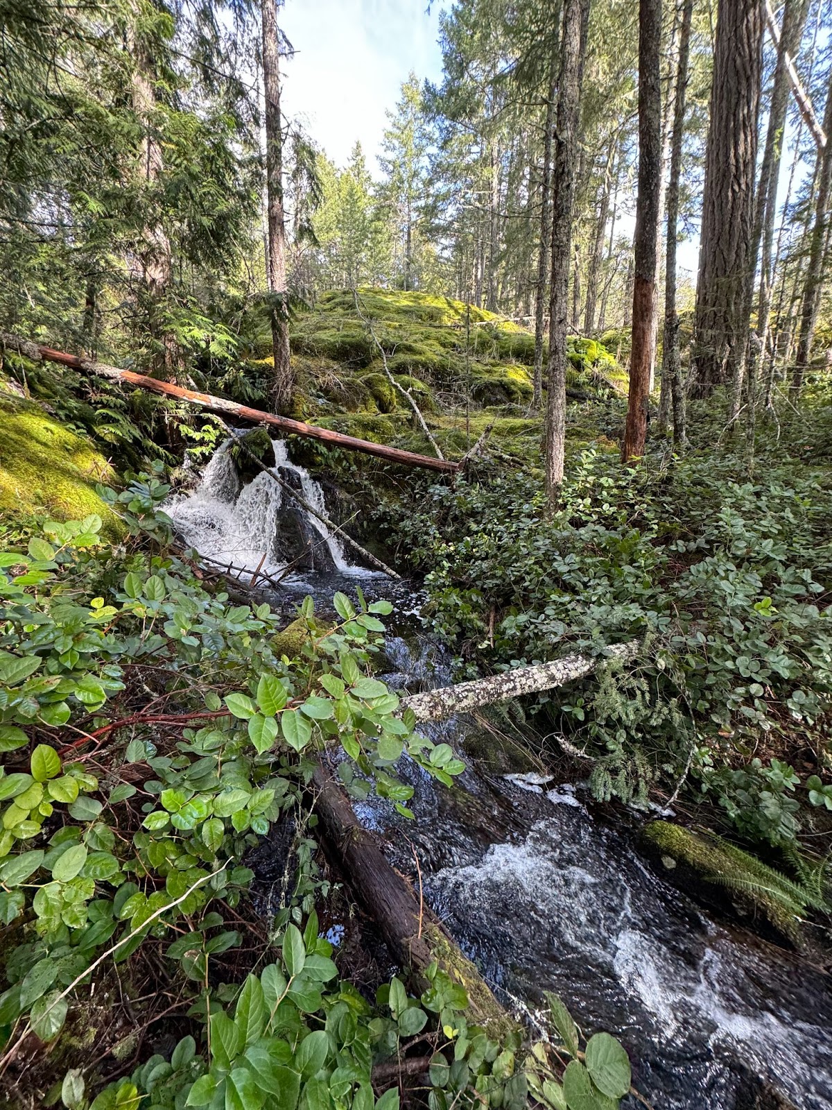
We continued along the trail, encountering some challenging trail-finding. On the descent from Larkspur North, we dropped into a small wetland feeding into Terry’s Coulee. Windfall blocked the trail here, so we bushwhacked through chest-high salal before reuniting with the trail.
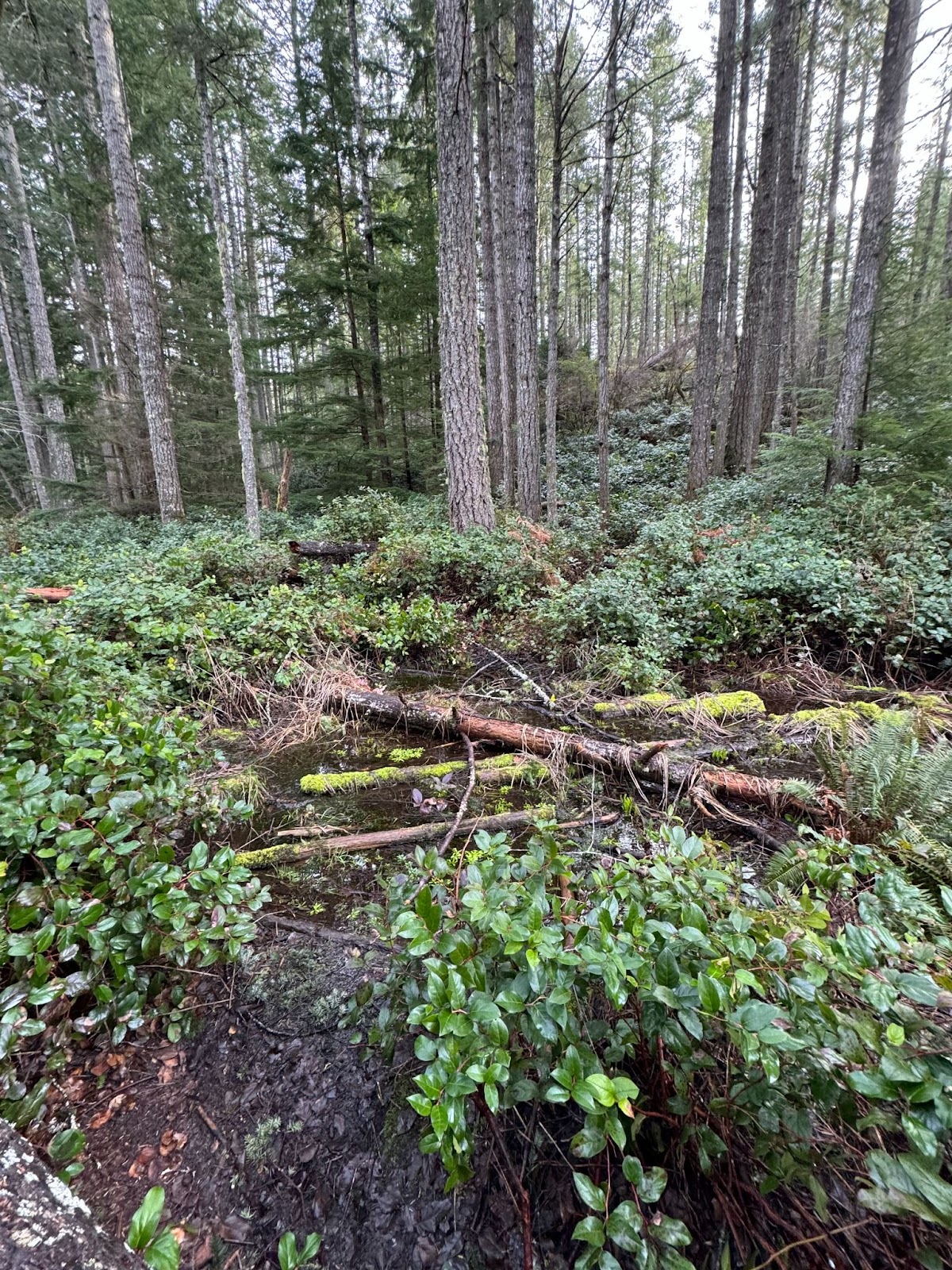
The trail improved, showing evidence of maintenance with a brush cutter, despite being unsanctioned. The sounds of pileated woodpeckers echoed through the tranquil wetland ecosystem as the sun began to break through.
- The Grind to Rick Hill: A 100-meter climb, relatively gradual with occasional steep steps and windfall to navigate.
- Rick Hill Summit: The peak offered a nice view east towards Mount Brulé and Quimper, and to the north, Monument Mountain. It was marked by a small cairn and surrounded by a thick blanket of moss and Arbutus trees.
Monument Mountain
- Descent to Judy’s Coulee: A steep 70-meter drop with rocky, slippery steps. Judy’s Coulee was easier to cross than Terry’s, with a small brook.
- The Grind to Monument Mountain: A 210-meter climb, offering scenic views to the northwest. The trail was steep but provided light exposure and some nice views.
Upon reaching the ridge, we followed a meandering path to the Monument Mountain Summit Trail. Evidence of mountain bikers was present in this section.
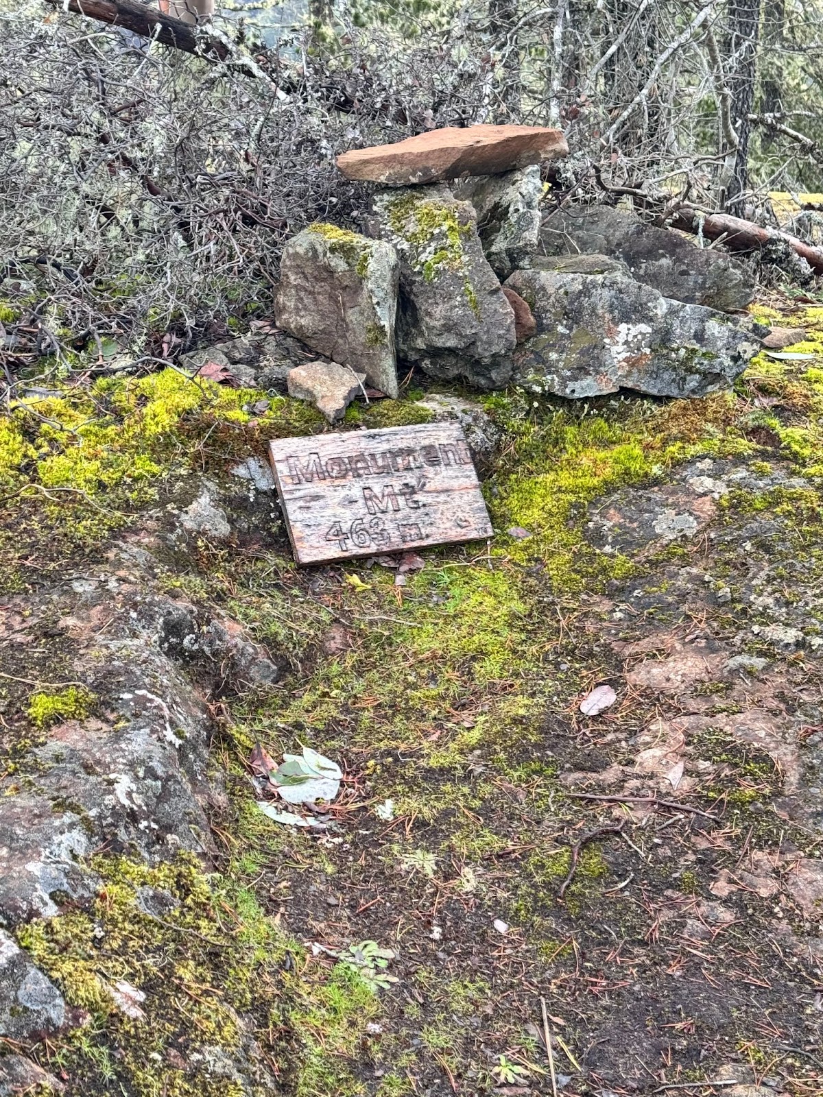
- Monument Mountain Summit: Marked by a small sign with the elevation (463 meters), offering a similar view to Rick Hill but obstructed by trees. The summit trail here was a sanctioned trail, with less blow-down and overgrown salal.
Towards Grass Lake
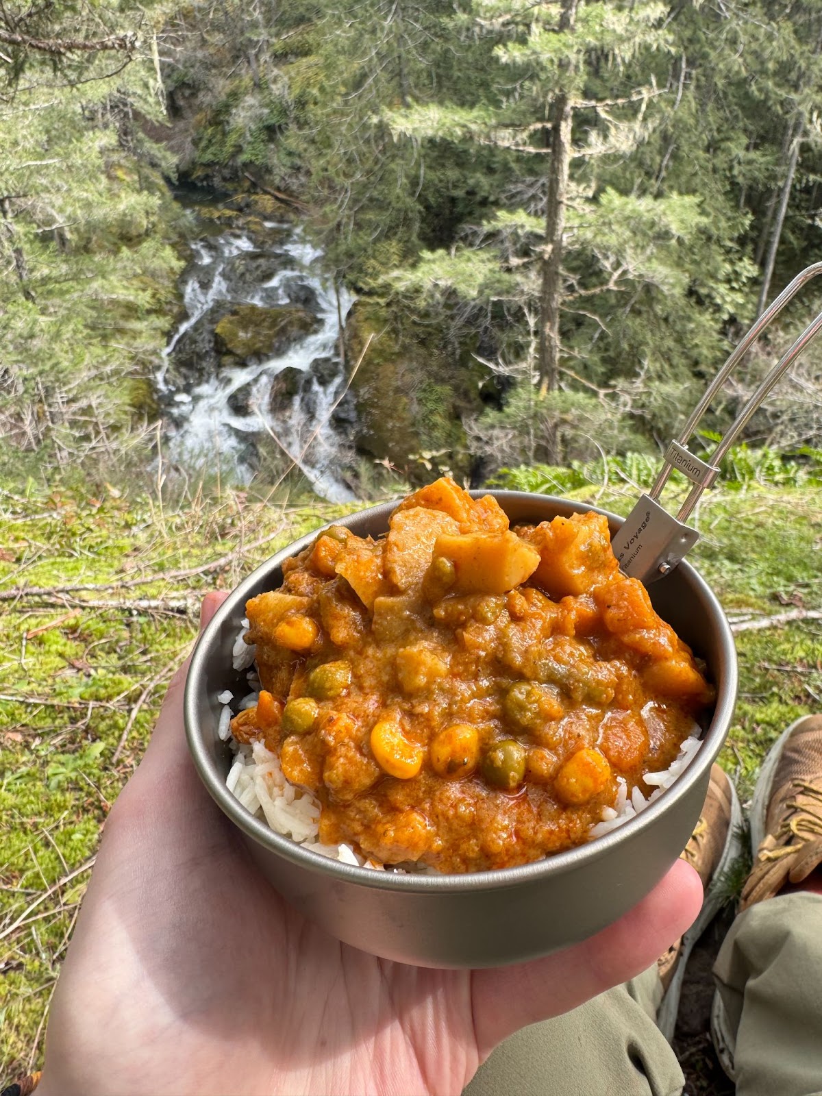
We dropped 20 meters, then climbed 50 meters to what I assume is the true peak of Monument Mountain, which I'll call Monument North. Feeling famished, we had a quick snack of trail mix before heading down to Grass Lake.
At Grass Lake, we encountered two other hikers, took some pictures, and then continued down the Grass Lake Trail, an old track that leads toward Devastation Hill.

Charters River Crossing
About 500 meters down the trail, we reached the North Charters River. The crossing was expected, but the other side was an endless expanse of salal. Knowing that Sooke Mountain Provincial Park is unmaintained and with no clear trail after the crossing, we decided to take a break, refill our water, and head back down the Grass Lake Trail.

Descent and Final Stretch
The trail started promisingly as an old truck road but quickly deteriorated into a highly eroded scree once it left Sea-to-Sea Regional Park. Both of us were recovering from knee injuries, making the scree especially difficult. Tendon pain started to set in as we descended.
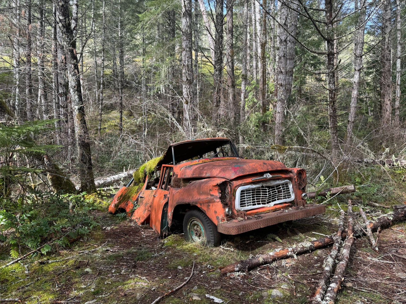
We stopped at an abandoned cabin site, where only the chimney and a truck remained, along with some artifacts. Further down the road, we stopped at the Charters River waterfall lookout for lunch. The view was pleasant, but the constant breeze in the valley made it chilly, so we packed up and continued to the vehicle.
Final Thoughts
The lower section of the Grass Lake Trail was better, following a sanctioned area and passing an old CRD reservoir and the Charters Dam. The trail seemed popular with dog walkers, so we encountered a few along the way. We finally returned to the vehicle around 2:30 PM.
- Stats:
- Distance: 14 km
- Elevation Gain: 630 meters
- Highlights: Four more of the Sooke Hills completed!